HAMPTON ROADS, VA — A slow-moving coastal storm kept flooding concerns in place across Hampton Roads and the Outer Banks on Saturday, with road closures, overwash and ferry disruptions changing throughout the day. Local and state agencies said residents and travelers should keep checking for updates as water levels and access conditions shifted.
In Norfolk, the National Weather Service extended a Coastal Flood Warning through 2 p.m. Sunday. Officials said minor to moderate tidal flooding was expected through the day, with some areas facing major flooding.
Elsewhere, Virginia Beach opened the Town Center municipal garages so residents could move vehicles away from flood-prone areas. On Hatteras Island, Dare County declared a state of emergency after NC 12 lost access and essential travel routes were interrupted.
Norfolk keeps crews on alert as tidal flooding continues
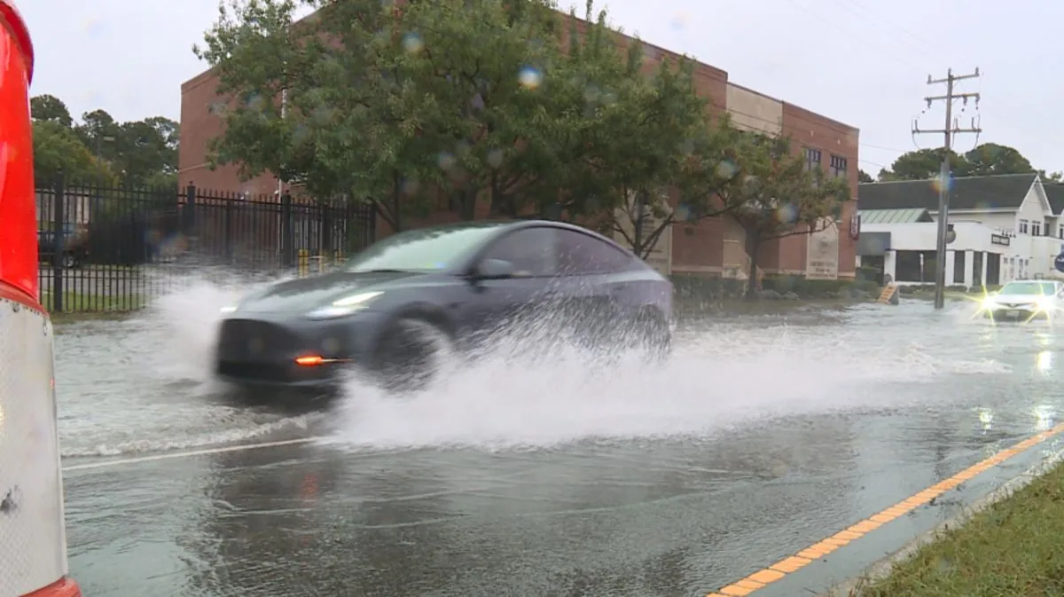
The City of Norfolk said it continued to monitor tidal flooding and coordinate response efforts across the city. Crews were still responding to flooding impacts as water covered low-lying streets and tidal areas.
Officials urged drivers and pedestrians to use caution when moving through flooded streets or around areas affected by tide-driven water. The warning remained in place as the coastal system lingered offshore and kept pushing water into vulnerable neighborhoods.
The National Weather Service said the flood threat could continue into Sunday afternoon, which meant some parts of the city could see the worst conditions during routine high-tide cycles. The extended warning gave residents additional time to make decisions about travel and parking near vulnerable waterfront areas.
Virginia Beach opens garages for residents moving cars out of flood zones
Virginia Beach officials said the Town Center municipal garages would stay open through Monday morning, Sept. 28, for residents who wanted to relocate vehicles out of flood-prone areas. The city offered the parking access as a practical step while the storm continued to affect coastal communities.
Flood-prone parking can become a significant problem during long-duration coastal events, especially when tides remain elevated over several cycles. By keeping the garages open, the city gave residents a place to store vehicles away from water before conditions changed again.
The city did not announce broader evacuation measures, but the garage access was part of the local response to the ongoing storm impacts. Officials continued encouraging residents to stay aware of changing conditions and to move vehicles if their neighborhoods are vulnerable to tidal flooding.
Hatteras Island enters emergency status after NC 12 loses access
Dare County declared a state of emergency for Hatteras Island Saturday evening because access along NC 12 was lost and emergency officials needed to move people, personnel and essential supplies on and off the island. The declaration tightened travel rules as the storm created continuing problems along the barrier island.
Under the emergency order, entry is limited to Priority One and Priority Two individuals. Visitors and non-resident property owners are not allowed to enter while the state of emergency remains in effect.
Officials said the declaration also allows residents of Ocracoke Island in Hyde County to travel through Hatteras Island to return home once ferry service resumes. Travelers needing entry credentials were directed to Dare County’s Reentry webpage for 2026 permits.
NC 12 stays shut in several sections after severe overwash
North Carolina transportation officials said NC 12 remained closed between the Marc Basnight Bridge and Rodanthe after severe ocean overwash at the Canal Zone and the Pea Island Visitor Center. Earlier in the day, the road was also reported closed between the Basnight Bridge and Doanthe, and on Ocracoke between the ferry terminal and the pony pens.
In the south end of the island, flooding was still affecting places including the Tri-Villages and Hatteras. Severe overwash was continuing at the Canal Zone and the Visitor Center, where water and sand were still creating hazardous travel conditions.
Despite the road problems, travel between Hatteras Island villages remained open. Soundside flooding was affecting some areas, but power, water and communications were still operating, according to county officials.
Avon Fishing Pier collapses as crews race to clear the roadway
The Avon Fishing Pier in Hatteras was extensively damaged overnight, according to a Facebook post from the pier, and one section collapsed fully into the ocean Saturday morning. The damage added another visible sign of the storm’s force along the island’s exposed shoreline.
Dare County Government said NCDOT crews were working to restore the protective berm and clear the roadway where conditions allowed. State transportation officials expected to finish a damage assessment later in the day.
County officials also said they were working with partners to get trucks carrying food, fuel, medical supplies and other essentials to Hatteras Island as soon as access allowed. That effort remained tied to the status of NC 12 and whether the road could be made passable again.
Ferry service may fluctuate as tides and wind affect loading ramps
In James City County, the Jamestown-Scotland Ferry could see intermittent service outages this weekend because of high tide levels. Officials said the greatest chance of interruptions would come around high tide Friday night, Saturday and Sunday.
High water and strong winds can make it unsafe to raise and lower the loading ramps on the docks onto the ferry boats. That can delay or stop service even when the ferry itself is otherwise ready to run.
Motorists were advised to plan for possible delays and check the ferry hotline at 800-VA-FERRY, or 800-823-3779, for the latest status. Travelers were also directed to the 511 Virginia website, the Virginia 511 mobile app, or the VDOT Hampton Roads District’s social media channels for updated travel information.